Human presence in Andros has probably been continuous since the 4th millennium B.C.
Numerous settlements were developed in the course of time. Although there has been considerable depopulation, particularly following the Second World War, 84 settlements and hamlets are still inhabited to this day.
A vast network of paths, stone-paved in many cases, used to provide links between the settlements as well as with religious sites and the island ports. With the gradual dominance of motorised transport, the use of paths declined and in many cases they were replaced by roads.
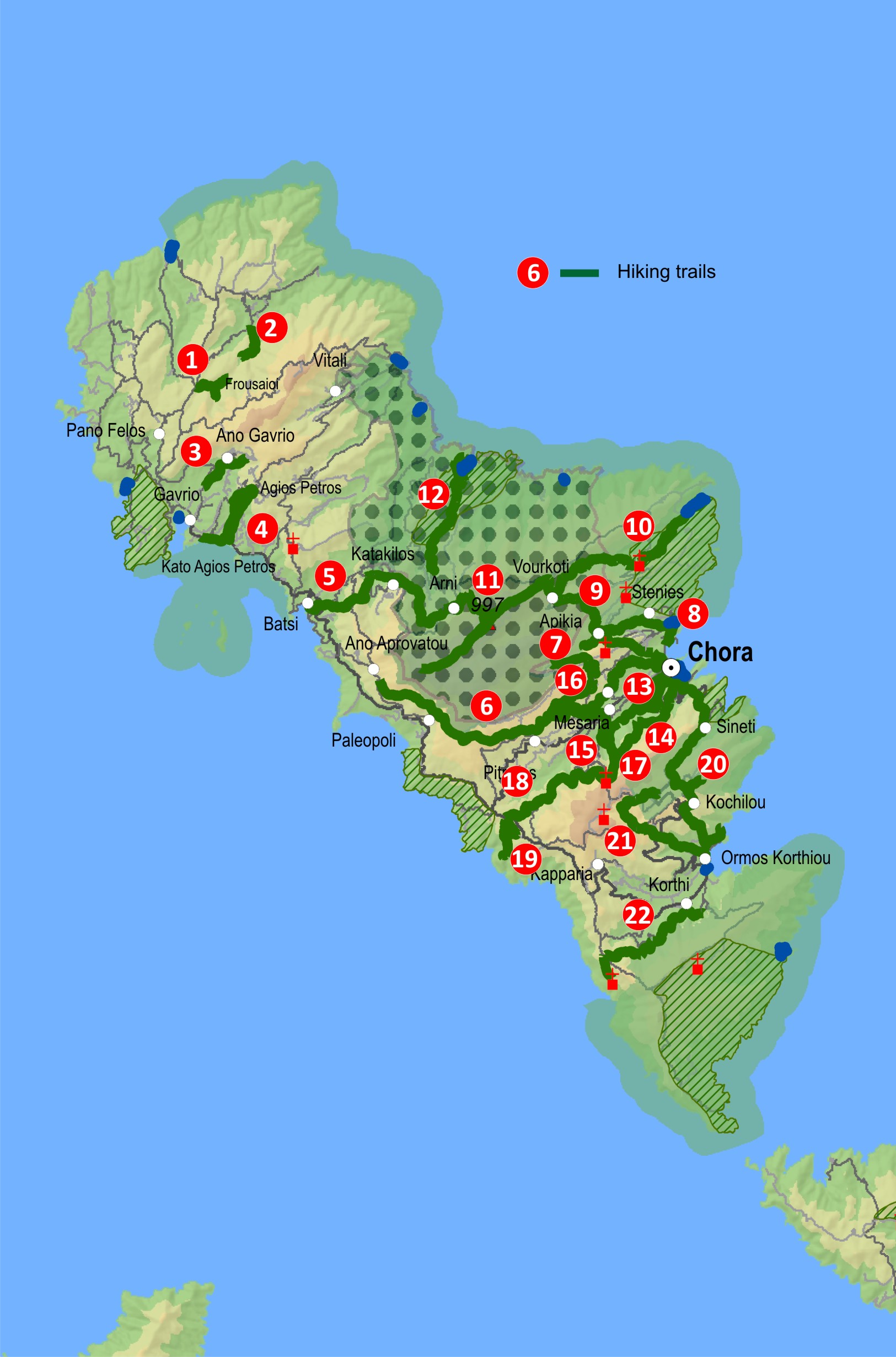
There still exist an impressive network of hiking paths to explore on Andros, which is estimated to exceed 300km in length. In 1997, in a joint effort to develop hiking tours on the island, the Cyclades Prefecture and the Andros Agency for Development undertook part of a project to clear and signpost 12 hiking routes about 85km long. Most of them are located in the central and southern part of the island, and recently some particularly interesting routes were added in the northern and western parts.
The last few years through our project all the existing paths and numerous new ones have been cleared and fully signaged (way marked and sign posted) following European standards managing to offer hikers a complete hiking network of 160km.
In October 2015, a continuous route of 100km, named “Andros Route” has received the European quality certification “Leading Quality Trails-Best of Europe”. Andros is considered to be today among the leading quality European destinations for hiking.
The network of hiking routes accessible today extends to 160 klm length.
The last few years the above hiking routes are maintained in a systematic way through our project and mostly with the help of our dedicated volunteers as well as with the help of payed working hands either offered by our supporters of from the sales of our book “Hiking on Andros”. Of great importance is also the involvement and contribution of other local voluntary organizations and associations.
Andros is a special island of the Cyclades with plenty of water reserves, mountainous terrain, a sharp relief and extremely varied scenery. Small forests, fertile valleys, numerous beaches, ravines with continuous water flow, streaming waterfalls and springs are found in almost every slope and valley. The uninterrupted human presence has left signs visible even at the remotest and steepest parts of the island, using stone as the basic material to create a handmade landscape. The variety of rural architecture is quite astounding: stone walls, terraced plots (“emasies” in the local dialect), oil mills, threshing floors, more than 200 recorded water mills, 69 windmills, scores of stone bridges some of which are arched and hundreds of rural chapels are scattered everywhere around the island.
Hikers and tourists alike, encounter dramatically different microcosms rich in biodiversity. Areas comprising almost half of the island are designated Natura, IBA sites (important sites for birds) or wildlife sanctuaries, where many rare or endemic species of flora and fauna find refuge.
You are invited to walk these paths and experience a rather “unknown” Andros, a dramatically different Cycladic island.


